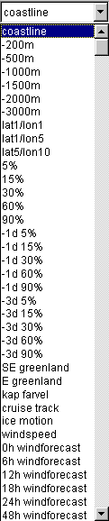
| (Northern
Hemisphere) coastline |
Coastline
for the entire area of coverage |
Varoius
localities coast
|
Higher
resolution coastline for these localities
|
| -200m |
bathymetry
200 meter depth contour |
| -500m |
bathymetry
500 meter depth contour |
| -1000m |
bathymetry
1000 meter depth contour |
| -1500m |
bathymetry
1500 meter depth contour |
| -2000m |
bathymetry
2000 meter depth contour |
| -3000m |
bathymetry
3000 meter depth contour |
| lat1/lon1 |
latitude-longitude
grid with grid spacing 1 degree latitude, 1 degree longitude |
| lat1/lon5 |
latitude-longitude
grid with grid spacing 1 degree latitude, 5 degree longitude |
| lat5/lon10 |
latitude-longitude
grid with grid spacing 5 degree latitude, 10 degree longitude |
Place names
|
Location of
weather stations etc. Mostly in the European sector of the Arctic
|
| 5%,
15%, 30%, 60%, 90% |
Ice
concentration contours from today. Contours derived from low resolution
SSM/I data (19 & 37 GHz only) |
| -1
d 5%, 15%, 30%, 60%, 90% |
Ice
concentration contours from yesterday. Contours derived from low
resolution
SSM/I data (19 & 37 GHz only) |
| -3
d 5%, 15%, 30%, 60%, 90% |
Ice
concentration contours from 3 days ago. Contours derived from low
resolution
SSM/I data (19 & 37 GHz only) |
| NNN
cruise
track |
Cruise
track from file |
| ice
motion |
ice
motion derived from
SSM/I data of yesterday and today |
| wind
speed |
Wind
observations from Ground
stations (discontinued)
|
| 0h,
6h, 12h, ... windforecast |
Weather
prediction model
output from NCEP (model run at 00 UTC) |
| 0h,
6h, 12h, ... waveforecast |
Weather
prediction model
output from NCEP (model run at 00 UTC) |
Icechart xxxx
dd/mm
|
Icechart from
US National Ice Center. dd/mm is date of validity, xxxx is area
baff=Baffin
Bay, balt=Baltic, bar=Barents Sea, beau=Beaufort Sea, ber=Bering Sea, cane=Canadian Archipelago
(east), chuk=Chukchi
Sea, esib=East Siberian
Sea, gren=Greenland
Sea, hiw=High Arctic
West, hiea=High Arctic
East, huds=Hudson Bay, kar=Kara Sea, lapt=Laptev Sea, okh=Sea of Okhotsk, whit=White Sea
|
envisat
coverage
|
Coverage of
ENVISAT Global Mapping Mode data with time of ENVISAT pass.
|
ers coverage
|
Coverage of
ERS PRI data
|
amsr.C xxx
|
xxx ice
concentration fraction contours from IOMASA optimal estimation algorithm
|
amsr.F xxx
|
xxx
multi-year ice fraction contours from IOMASA optimal estimation
algorithm |
qscat.HH xxx
|
xxx
backscatter contour from quickscat data
|
qscat.POL xxx
|
xxx
polarization contour from quickscat. POL=0 is normally very close to
the ice limit.
|